ORTHOMOSAIC DRONE MAPPING
Orthographic Map & Track Photography
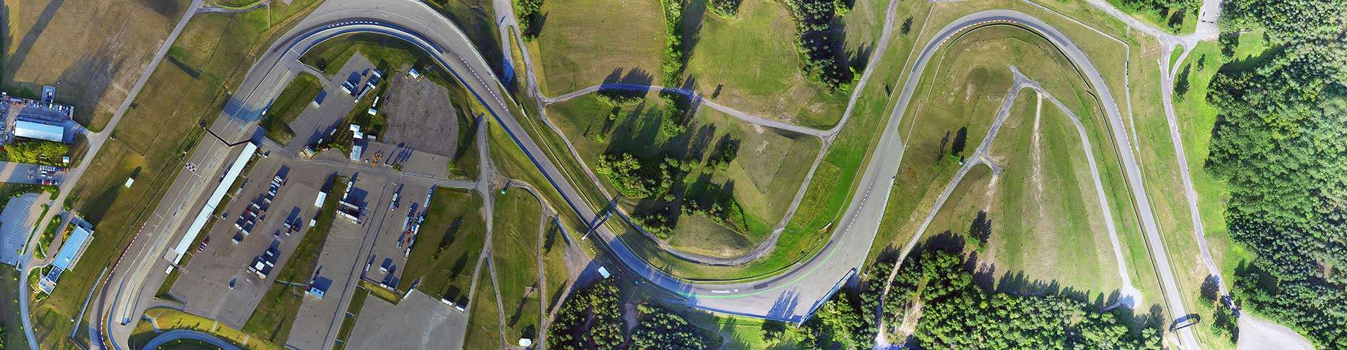
Canadian Tire Mosport Park
Bowmanville, Ontario
UAV Ontario were engaged by the Milestone (milestone.it) company of Italy to provide a variety of reference photography and a an entire aerial survey of the Mosport race track for their video game development.
UAV Ontario were tasked to produce a 360 degree video of the entire track, an orthomosaic photo of the entire property (395 acres) as well as additional reference photography including aerial panoramas of all track corners and precise photography of all track textures. With the data from the 1000’s of images gathered we produced the completed GeoTIFF file as well as the RAW imagery and a 3D Model of the entire track.
![]()
Please browse the completed rendered images and be sure to contact us for all of your aerial survey and orthomosaic drone mapping requirements in Ontario.
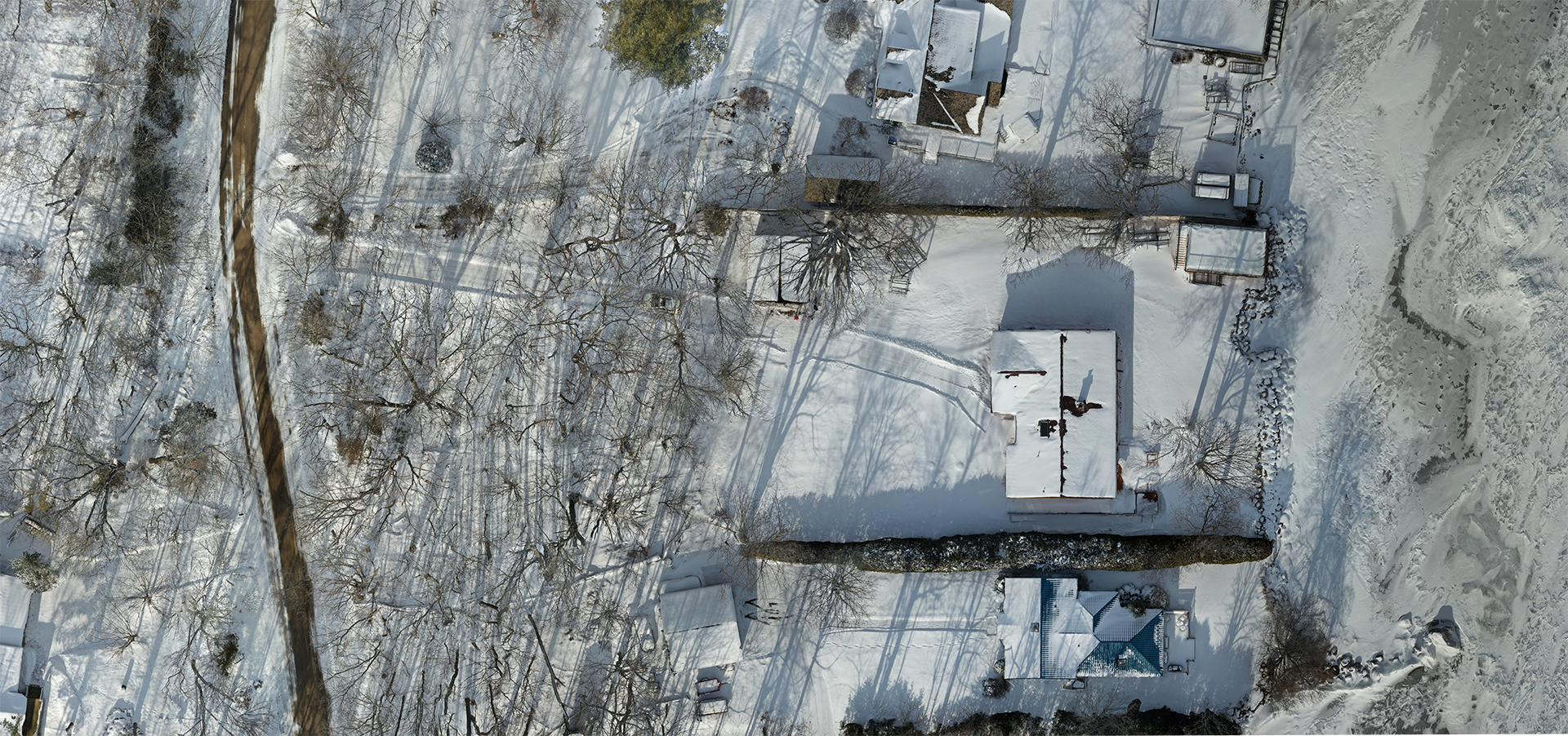
Simcoe County: Environmental Assessment
Innisfil, Ontario
UAV Ontario were engaged to provide a drone survey of a waterfront property on the Lake Simcoe shores. Our client was required to provide current imagery for their proposal that was not available through the county maps or archives.

Although snow and bare trees are some of the most difficult circumstances to render orthomosaic images, the job was completed ahead of schedule and delivered successfully to the client as per their specific requirements.
Topographic/Orthographic Imagery
Guelph, Ontario
UAV Ontario were engaged to provide a drone survey of an industrial development site to provide current grading requirements as well as a tree count for the property to the customer. Our deliverables included oblique site-survey imagery as well as a high-resolution orthographic image at 2CM per pixel resolution and the related AutoCAD files with the completed contour lines.
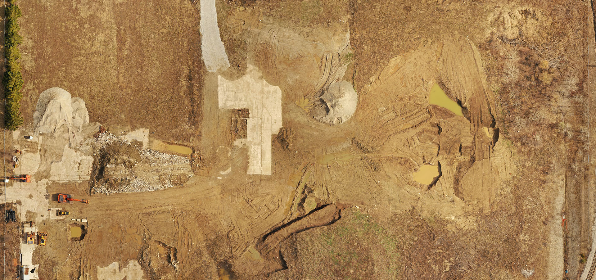
Ground Control Points with Georeferencing can achieve X,Y accuracy within 2cm when combined with an accurate ground survey by a land surveyor or using equipment such as and RTK GPS. Once accurate ground control points are captured, they can be included in the post-production workflow to provided corrections to the photogrammetric map or 3D models.